
|
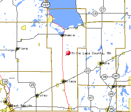
County land area - 574 square miles Population - 26,097 (2010 Census) |
| (T)owns/Cities - Townships (Twp) | 1998 Population in Mille Lacs County | 2003 Population in Mille Lacs County | % Increase Population in Mille Lacs County | 1998 Households in Mille Lacs County | 2003 Households in Mille Lacs County | % Increase Households in Mille Lacs County | |
| Bock (T) | 122 | 108 | (11%) | 44 | 47 | 7% | |
| Bogus Brook (Twp) | 1,001 | 1,211 | 21% | 340 | 414 | 22% | |
| Borgholm (Twp) | 1,145 | 1,371 | 20% | 392 | 483 | 23% | |
| Bradbury (Twp) | 171 | 231 | 35% | 64 | 79 | 23% | |
| Dailey (Twp) | 225 | 267 | 19% | 87 | 97 | 11% | |
| East Side (Twp) | 697 | 745 | 7% | 305 | 355 | 16% | |
| Foreston (T) | 375 | 442 | 18% | 130 | 167 | 28% | |
| Greenbush (Twp) | 1,108 | 1,252 | 13% | 370 | 439 | 19% | |
| Hayland (Twp) | 380 | 543 | 43% | 139 | 197 | 42% | |
| Isle (T) | 650 | 769 | 18% | 296 | 354 | 20% | |
| Isle Harbor (Twp) | 476 | 602 | 26% | 189 | 248 | 31% | |
| Kathio (Twp) | 1,063 | 1,356 | 28% | 360 | 508 | 41% | |
| Lewis (Twp) | 47 | 53 | 13% | 22 | 26 | 18% | |
| Milaca (T) | 2,385 | 2,652 | 11% | 1,020 | 1,180 | 16% | |
| Milaca (Twp) | 1,187 | 1,392 | 17% | 389 | 489 | 26% | |
| Milo (Twp) | 1,100 | 1,280 | 16% | 360 | 436 | 21% | |
| Mudgett (Twp) | 96 | 83 | (14%) | 32 | 35 | 9% | |
| Onamia (T) | 822 | 866 | 5% | 308 | 325 | 6% | |
| Onamia (Twp) | 587 | 652 | 11% | 222 | 245 | 10% | |
| Page (Twp) | 509 | 695 | 37% | 189 | 246 | 30% | |
| Pease (T) | 167 | 168 | 1% | 64 | 64 | - | |
| Princeton (T) | 3,974 | 4,199 | 6% | 1,579 | 1,777 | 13% | |
| Princeton (Twp) | 1,847 | 2,075 | 12% | 646 | 747 | 16% | |
| South Harbor (Twp) | 677 | 917 | 35% | 281 | 380 | 35% | |
| Wahkon (T) | 215 | 324 | 51% | 106 | 155 | 46% |
Source: Minnesota State Planning Agency / State Demographic Center
Go to Profile - Biographies - Historical Photo Album - Queries - Resource Links - Surnames - Vital Records
Back to Table of Contents
Last Updated January 29, 2012
Copyright © 2000 Ron Zurek